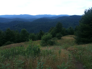
Tuesday, July 20, 2010

Day 127 - 7/20

Daily mileage: 12.2
Total trail mileage: 1749.5
Starting location: Hanover, NH
Ending location: Moose Mountain North Peak
Weather: 73-78 degrees during the day. Alternating cloudy and partly
cloudy throughout the day. On and off drizzle in the afternoon

I am at
http://maps.google.com/maps?q=43.740520,+-72.136917

Staying in town for the donut french toast was worth it. It was quite
good but probably horrible for you. Good thing I need calories!
After that I took care of a few online bills at the DOC (Dartmouth
Outdoor Center; they have computers to use), picked up some new
insoles from the outfitter, and hit the trail by 11.

I am now done with 80 percent of the trail. Under 430 miles left to
go! 430 miles really isn't that far. I finished that by the time I
hit Damascus, VA, which feels like so long ago.

I made good time today but decided to stop early and finish my book.
I am headed to Glencliff on Thursday as it is the last chance to do
laundry for a while. So, I don't need to kill myself doing long days
until then. The trail today was a nice section of trail, but it
didn't have anything worth mentioning.

Takeout Indian food was an awesome idea. Sure, it is heavy, but I am
only carrying food for a couple days. And, I have to carry the empty
containers, but I'll manage.

I heard from a Southbounder that someone died in the White Mountains
yesterday. I don't know the details but it was supposedly around
Tuckerman's Rivine and involved some sort of slip on the wet rock.
Even a relatively safe activity like hiking unfortunately has risks.

There are hundreds of mosquitoes around my hammock. I really don't
want to leave my hammock, but I haven't eaten dinner yet. Hopefully I
finish eating before they do. Ok, I had to risk dropping food and
brought dinner into the hammock with me. Yes, the mosquitoes are that
bad :(

Monday, July 19, 2010

Day 126 - 7/19

Daily mileage: 20.6
Total trail mileage: 1737.3
Starting location: Barnard Brook
Ending location: Hanover, NH
Weather: 63 degrees in the morning, 66-77 degrees during the day.
Mostly cloudy and cloudy in the morning. Rain in the late morning.
Partly cloudy in the afternoon. Rain in the early evening

I am at
http://maps.google.com/maps?q=43.700893,+-72.286144

Snaker was nice enough to wake me up early (I had asked him to), so I
got on the trail by 6:30. I was making really good time today and
barely stopped at all. It didn't feel like a 20 mile day and I
reached town by 4:30. Of course, a bit of road walking helped (road
walking hurts my feet but I can make better time), and the trail was
pretty easy today.

There were a number of sections of really tall grass where the trail
was really narrow. There wasn't much in the way of blazing, so a few
times it was guesswork. The tall grass wasn't too bad in the morning
since I didn't see any ticks, but as soon as it rained I was drenched
on my bottom half from the wet grass. On the other hand, I am liking
the rain jacket. It again kept my upper body completely dry.

At one point there was a field mouse (or some other rodent) in the
trail. It saw me, darted 3 inches, and stuck its head under a leaf.
Good thing I am not a predator, because its back end was sticking out
in the open. I had to tap it on the side with my trekking pole to get
it to properly run so I didn't accidentally step on it.

I HAVE NOW COMPLETED MY TWELFTH STATE! Vermont is done. I am sad to
see it completed, but that leaves me with just New Hampshire and Maine
to go. Vermont had a lot of mud, streams, ponds, smooth terrain
(relative to the other states), and nice pine and birch forests. The
border between VT and NH has the nicest indicator sign so far for any
state transition. It is embedded in the bridge crossing the river.

Given that I made it into town at a reasonable time, I was planning on
continueing through and camping past town. But, Patrick left me a
voicemail with some recommendations (he went to Dartmouth) including a
breakfast place with donut french toast. It sounds like a
fantastically bad idea so I need to stay until the morning to try it.

The end of Vermont and beginning of New Hampshire has been awesome
trail magic so far. First there was watermelon and banana bread by
someone's mailbox. Then there were maple cookies by another person's
mailbox. Then there was a water bowl by a third mailbox (I think that
one was for a dog). One of the pizza places in town gives a free
slice to thruhikers (which of course meant that I had to get more and
a beer). Ben and Jerry's gives a 10 percent discount to thruhikers.
One of the fraternities lets a few hikers stay at their house for free
(thanks Lonestar for the tip!).

I ran into a few of the guys (Hopi, Corny, I am blanking on the
third's name) as soon as I got into town. Hanover is busier than I
expected and is such a shock after coming out of the woods. So many
cars and people! I found a replacement bite valve for my bladder,
picked up a few food supplies, ate pizza, and ran into Traveler (who I
hadn't seen since Georgia until yesterday).

Traveler and I wanted to attempt a Vermonster (20 scoops of ice cream,
2 cookies, a brownie, 4 bananas, 4 toppings, and whipped cream), but
we needed another person or two. We couldn't find any of the other
hikers so we started trying to recruit off the street. College kids
are pretty sad these days...we couldn't convince anyone to eat
icecream. Then, the people at Ben and Jerrys told us we could do a
half-Vermonster (which we called the Verwimpster), so we agreed to
that. It kicked our butts. We are so ashamed; we shouldn't be called
thruhikers. It was much worse than the half gallon challenge because
of all the toppings.

After that I picked up takeout Indian food to take with me on the
trail (yum!) and went to the fraternity house. This is pretty sweet.
They are letting me stay in their movie room with pillows and cushions
all over the place, and they let me use the shower.

I don't know when I will leave tomorrow. I was afraid of getting
sucked into town again.

Sunday, July 18, 2010

Day 125 - 7/18

Daily mileage: 13.5
Total trail mileage: 1716.7 (approx)
Starting location: After Mink Brook
Ending location: Barnard Brook
Weather: 68 degrees in the morning, 71-79 degrees during the day.
Clear and sunny in the morning. Partly cloudy the rest of the day.

I am at
http://maps.google.com/maps?q=43.675356,+-72.550809

Last night was perfectly calm, but I could see flashes from lightning
in the distance. I didn't hear any thunder though. A few minutes
later the wind picked up. A storm never did come through, so it was
probably very isolated.

Today was supposed to be my long day. Oops. I woke up in the morning
but was so comfortable that I couldn't convince myself to get up. So,
I went back to sleep. 2 hours later I finally got out of the
hammock. I got 11.5 hours of sleep last night. I guess I was tired.

Then, I was talking to various people all day, so I kept losing even
more time. Then, I ran into Snaker setting up camp by a brook. It
was still early in the day, but it looked like a nice spot and he
convinced me to stay. So, I stopped much earlier than I had planned to.

I didn't realize just how little I traveled though until I pulled out
the guidebook. Oh well. Either tomorrow will be a really long day
into Hanover, or I will hit Hanover the next morning. The problem is
that I am pretty much out of food, so I probably need to push to
Hanover tomorrow. I wasn't planning on staying in town (just pick up
lunch and supplies), but I may have to camp in town (there is a place
that hikers are allowed to camp) depending on when I arrive and when
the outfitters close.

There was a sidetrail today to a private cabin that is left open for
hikers. It had a platform on the roof, which had amazing views. The
view today was what I was hoping for from Killington. And the weather
this morning was almost perfect (cooler, clear, slight breeze). It
felt like Fall. Hopefully I get more days like the morning.

Saturday, July 17, 2010

Day 124 - 7/17

Daily mileage: 10.1
Total trail mileage: 1703.2 (approx)
Starting location: Sherburne Pass Trail
Ending location: After Mink Brook
Weather: 72-84 degrees during the day. Partly cloudy all day.

I am at
http://maps.google.com/maps?q=43.687859,+-72.704439

I met even more friendly hikers this morning at breakfast. The Inn at
the Long Trail is great :). There are AT hikers headed in both
directions, LT hikers headed in both directions, section hikers, day
hikers, past AT and LT hikers, and people that are coming for the live
music. Everyone has different stories to tell. I am glad I stopped
in, even if I couldn't get a room right away.

I did get a late start though. I didn't get back to the trail until
11. Even if you ignore the start time, for some reason I was making
awful time today. I didn't think I was going slower than my average
pace, but I didn't cover the ground that I had expected to. I was
hoping to go a few more miles today, but I decided to just stop early
(the earliest I have stopped in a long time) and get some sleep (I
went to bed late and woke up early).

I passed by a really cool waterfall today as well as smaller but also
interesting falls. Shortly after the Inn at the Long Trail there was
also a pond. The climb after the big waterfall was much steeper and
longer than what I remember. It felt like it was much harder than the
climb up Killington.

Apparently someone did go the wrong way at the Maine Junction. The
Maine Junction was the point where the Long Trail and Appalachian
Trail split. The problem is that both trails are blazed with the same
white markers. If you didn't know about the Long Trail or weren't
paying attention to the signs I could see you going the wrong way.
And, it would probably be a while before you realized the mistake.
According to the blazes, it would look like you were on the right trail.

I am shooting for a long day tomorrow and then I think I can get away
with doing 15-mile days for a bit. Almost to New Hampshire!

Day 123 - 7/16

Daily mileage: 18.8
Total trail mileage: 1693.1
Starting location: Before Clarendon Shelter
Ending location: Sherburne Pass Trail
Weather: 71 degrees in the morning. 68-79 degrees during the day.
Clear and sunny in the morning. Cloudy in the afternoon. Brief heavy
rain midday. On and off drizzle the rest of the afternoon.
Thunderstorm in the late afternoon.

I am at
http://maps.google.com/maps?q=43.663185,+-72.832463

The weather started out ok today. The section between Clarendon
Shelter and Governor Clement Shelter was much nicer without it raining
(it was raining when I last went through that section). But then the
clouds moved in and it started raining. The temperature quickly rose
in the morning but then fell throughout the rest of the day. I think
part of it was the clouds moving in and part of it was the elevation
gain.

So, I am 0 for 2 for views on Killington. I didn't even bother
climbing the last 0.2 miles to the peak. I wouldn't have been able to
see anything other than a white cloud. D'oh! I hope I get better
luck when going through the Whites.

Speaking of the Whites, I have been seeing a few Southbounders each
day now. And, I have been getting reports from the Whites. Someone
said that 2 weeks ago there was enough snow on Mt. Washington that
they had to shut down the road. Another person said that there were
80-mph winds, snow, ice, and 14 degree temperatures at the beginning
of July.

The new Marmot Super Mica jacket is working out so far. It was
comfortable to wear while hiking, even while doing a 2000 ft climb
part way up Killington. It also kept me dry. The only problem is
that the patches of reinforced material (to prevent wear) are not
under my hip belt. Oh, well, I got a size larger than I should have
to make sure I could fit my cold weather clothing under it. I guess
they didn't have a 5'4" guy in mind when they determined the placement
of the patches.

I made my way to the Inn at the Long Trail. I didn't really have to
stop, but when I did the Long Trail I had decided that if I ever did
the AT I had to stop here. Unfortunately though, they didn't have any
hiker rooms available (I am not surprised as it is a weekend). So, I
have set up my hammock across the street and am getting dinner at the
pub room. I met a few people that did a thruhike in 2007 and are
starting the Long Trail tomorrow. There is also live music tonight.
I do feel like a hobo though; I am living across the street in the
woods.

Scratch that, two other hikers came in and we are splitting the one
remaining more expensive rooms. So, I took down my hammock and am no
longer a hobo. One of my roommates thruhiked in 2007; the other is
section hiking. We ended up swapping stories until way too late.

I am now done with the stint that runs along with the Long Trail :(.
At this point the Long Trail heads to Canada and the AT heads East.
In the past two days I covered the same mileage that my dad and I
covered in four days when we did the Long Trail. But, I do think I
flew by the area a little too quickly this time. And, my feet would
agree (they are torn up a little again).

I have no idea what the plan is tomorrow. Obviously get up for
breakfast but after that I'll see where I end up.

Thursday, July 15, 2010

Day 122 - 7/15

Daily mileage: 20.1
Total trail mileage: 1674.3 (approx)
Starting location: Baker Peak
Ending location: Before Clarendon Shelter
Weather: 67 degrees in the morning. 75-79 degrees during the day.
Clear and sunny all day.

I am at
http://maps.google.com/maps?q=43.525579,+-72.922139

I forgot to mention yesterday that I went over my first ski slope of
the trip. I had gone over ski mountains prior, but the trail was on
the other side of the mountain. Yesterday the trail actually went up
a ski slope. Unfortunately though no snow. Hmm, or maybe that was
fortunate given that I was going up the slope?

Today I had my first river ford of the trip. The Big Branch Bridge is
being replaced. Yea, they provided a "recommended" 6-mile or so
detour, but I didn't mind getting wet today and I could use the
practice before hitting the Maine stream fords. Well, it turns out
the trip across the river was actually very easy. The water never
came up above my knee. I have had more difficult crossings over mud
puddles. I was really glad I didn't take the unnecessary detour.

The trail was fairly easy today even though there was a decent amount
of elevation gain and loss. However, at the end of the day my feet
were complaining. Today included a pond, a lake, a number of streams
and rivers, a number of fantastic views, a waterfall, and a climb down
into and then back out of a gorge. The gorge was just as steep as I
remember.

I really need to start getting into camp earlier. Around 8 is about
the time that the mosquitoes are at their worst. If I stop around
then, I generally cook around then. One bite of food, smack, smack,
swat, smack, repeat. I want to finish eating as quickly as possible
so I can jump in the protected hammock.

Wednesday, July 14, 2010

Day 121 - 7/14

Daily mileage: 12.8
Total trail mileage: 1654.2
Starting location: Rt 11 & 30
Ending location: Baker Peak
Weather: 72-77 degrees during the day. Cloudy all day. Rain in the
morning

I am at
http://maps.google.com/maps?q=43.324482,+-72.964055

I got a late start (as expected), but it turned out to actually be
pretty good timing. The rain stopped by the time I started. It was
still cloudy all day, but at least I wasn't getting wet. Although, I
do kinda want to test my new rain jacket. I know, I know, it will
rain soon enough.

I got somewhat of a view from Bromley. Not the best, but
significantly better than the last time I was there. The last time it
was torrential downpour and visibility was quite poor.

I just spent the last two days going through my gear and seeing what
needed to be cleaned, repaired, or replaced. So, of course, on the
first day out I lose my bite valve for my water bladder. It must have
gotten caught on a branch and pulled off. Fortunately I have an on/
off valve so the water doesn't just pour out. On the otherhand, I
would have known about the missing bite valve much sooner. I was
going to go back to find it, but it could have been up to 2 miles
back. Oh well, I'll pick up a new one at the next outfitter and use
the on/off valve until then.

I ran into someone (AJ) who my dad and I had hiked with during the
Long Trail hike. The last time I saw him we were on Mt Mansfield. He
and his friend Adam were waiting up for a friend. I also ran into
that same friend today. It turns out she is the caretaker for
Griffith Lake.

I am camping right near Baker Peak. I went back to the peak for the
sunset and dinner. As I was making dinner a cloud rolled through
completely blocking the view. But then it started to thin and the
cloud turned various shades of yellow and orange thanks to the
sunlight. After it cleared, I got an awesomely interesting sunset
with the mountains all around me, the clouds passing below me and
above me, and the light bouncing off the clouds. This was probably my
best set of photos of the entire trip so far. I wish I had my real
camera :(

Spending the last two days bug-free and bug-noise-free was nice...

Day 120 - 7/13

Daily mileage: 0.0
Total trail mileage: 1641.4
Starting location: Rt 11 & 30
Ending location: Rt 11 & 30
Weather: Cloudy all day. Drizzle in the afternoon.

I am at
http://maps.google.com/maps?q=43.263264,+-72.594768

A second day in a row off.

Some chores, some reading, some tv, some eating, and some boardgames.

My new rain jacket came today and so far I like it. It seems to
actually be waterproof, but the real test will be when I use it in the
wild.

Tomorrow I head back to the trail to begin the final section :)

Tuesday, July 13, 2010

Day 119 - 7/12

Daily mileage: 0.0
Total trail mileage: 1641.4
Starting location: Rt 11 & 30
Ending location: Rt 11 & 30
Weather: Clear and sunny all day.

I am at
http://maps.google.com/maps?q=43.263264,+-72.594768

A day off :)

I tested out my rain jacket in the shower. Yep, it leaks; it really
didn't take long before my tshirt underneath was soaked. So, I read a
bunch of reviews and finally decided on a new rain jacket (Marmot
Super Mica). It has been ordered and will hopefully arrive tomorrow.
I am also switching out my sleeping bag and clothes stuff sack for a
lightweight drysack. I don't want things to get wet as I approach the
unpredictable NH weather and the Maine stream fords.

I started to look at my options for a follow-up trip in September.
Yosemite is a likely candidate, but I will still need to work out
details as I get closer to Katahdin.

I had sent a few real people clothes (non-hiking clothes) to my
parents before I got back on the trail. First, it is weird wearing
cotton. It is the first time I have cotton on since May. Second, I
lost even more weight and forgot to include a belt in my suitcase.
Good thing I don't have to go anywhere in public.

I cooked dinner, got caught up on email, and took care of other
chores. My brother and his girlfriend showed up late. I am taking a
second day off tomorrow to finish a few additional chores.

Monday, July 12, 2010

Day 118 - 7/11

Daily mileage: 10.4
Total trail mileage: 1641.4
Starting location: After Stratton Pond
Ending location: Rt 11 & 30
Weather: 63 degrees in the morning. 73-75 degrees during the day.
Clear and sunny all day.

I am at
http://maps.google.com/maps?q=43.263264,+-72.594768

I got up early and hiked out to the parking lot by Bromley. It was an
easy hike today and went quickly.

I reached the Spruce Peak Shelter, the location where I camped on a
warmup trip in January. It was much different now. Where did all the
snow go?? It was a much quicker hike today though. What took me
45-60 minutes on snowshoes took me 10-15 minutes today. There are
apparently a few large rocks on the trail that I didn't know were
there in January.

At the Spruce Peak Shelter I stopped to read the log book and checked
back to January to see if I wrote anything when I last passed
through. I apparently didn't, but I did see an entry by my old Boy
Scout Troop. It looks like they were at the shelter mid-January and
built quincees (sp?) and everything.

My mom met me at the parking lot and I headed back to my parents'
house for a few days off. Now is a chance to fix any gear that I need
to before beginning on the final stage of the hike.

Saturday, July 10, 2010

Day 117 - 7/10

Daily mileage: 19.6
Total trail mileage: 1631.0 (approx)
Starting location: Goddard Shelter
Ending location: After Stratton Pond
Weather: 65 degrees in the morning. 66-70 degrees during the day.
Cloudy all day. Rain starting last night and continuing through until
late morning.

I am at
http://maps.google.com/maps?q=43.104246,+-72.964884

The temperature dropped today, and the bugs in the morning were
reduced. But, the price to pay was getting rain. I'd pay it again.
It was so much nicer and easier to hike in cooler weather. I even
hiked the 1700-foot climb up Stratton without stopping. That would
have been nearly impossible a couple days ago. At times I felt like
jogging although I didn't because I didn't want to slip on the wet
roots and rocks.

I am not sure how much good my rain jacket is doing anymore though.
It felt like the water was just going through it. Is it time for a
new jacket? I like the jacket for wind protection, for light snow,
and for cold weather. For rain, it has never been great, and I think
the lining is wearing down.

There were so many good water sources along the hike today. It seemed
like every 10 feet there was a crystal clear stream flowing across the
trail. Of course today was the day when I didn't need copious amounts
of water. I wish I could move some of the streams to a dry stretch
like NY. And, why I am rearranging the trail, I would move some of
the rocks from PA into the mud fields here in VT. That way PA would
be a little smoother and hikers could more easily avoid the muddy
spots in VT.

Unfortunately there was no view at the Glastenbury fire tower and a
limited view at the Stratton fire tower. By the time I got to
Stratton Pond though a lot of the clouds moved off.

There were a million people at the Stratton Pond Shelter. I wasn't
allowed to hammock there and the bugs would eat me alive if I didn't
hammock, so I decided to continue on just a bit. I had dinner by the
pond along with some other people. I met a few others who are doing
the Long Trail. Then I continued to the other side of the pond and
found a spot in the woods for my hammock.

I am getting off the trail tomorrow at Rt 11 and heading to my
parents' house. The plan is to catch the final World Cup game (go
Netherlands!...I met two girls yesterday that live in the Netherlands
that told me I had to root for their team). Then I'll take a day or
two off before returning to the trail.

Day 116 - 7/09

Daily mileage: 21.6
Total trail mileage: 1611.4
Starting location: Seth Warner Shelter
Ending location: Goddard Shelter
Weather: 67 degrees in the morning. 73-84 degrees during the day.
Cloudy and foggy in the morning. Partly cloudy the rest of the day

I am at
http://maps.google.com/maps?q=42.974524,+-73.071979

It is interesting to go through these sections that I have gone
through before. The descent down to Rt 9 and the climb out from Rt 9
did not feel as steep as I remember. On the Long Trail trip there was
a peak that we thought we reached several times; on this trip I barely
recognized that I was going up a hill. I passed a spot where we had
breakfast on the Long Trail hike and where I had a snack on a previous
trip. The climb up to Goddard Shelter wasn't bad at all.

The hike today was pretty easy. So far Vermont is just as great as I
remember. It is nice to have sections with very few rocks. I can see
though why people say Vermont is very muddy. It has been a dry year
this year and there have already been many spots of mud. It is not
bad at all, but it is more muddy than any of the other states I have
passed through so far.

The temperature cooled a little, but it was still too hot. So, I
stopped at the brook by Rt 9. The water wasn't quite as cold as the
brook yesterday.

I flushed a whole lot of grouse today. At one point half a dozen
started flying in all different directions. One was acting injured
and whining like a dog. I am guessing it was trying to pull me away
from the nest. I haven't seen grouse for a while.

I hope I can get a view from the firetowers on Glastenbury and
Stratton tomorrow.

Thursday, July 8, 2010

Day 115 - 7/08

Daily mileage: 16.5
Total trail mileage: 1589.8
Starting location: Mark Noepel Lean-to
Ending location: Seth Warner Shelter
Weather: 77 degrees in the morning. 78-90 degrees during the day.
Cloudy and foggy in the morning. Partly cloudy and hazy in the
afternoon

I am at
http://maps.google.com/maps?q=42.772227,+-73.137715

We finished the climb up Mt. Greylock this morning. The rest of the
climb wasn't bad at all. Then my dad and I had breakfast at the
Lodge. Unfortunately, it was clouded over so what should have been a
great view wasn't. I went up the monument and still no view.
Occassionally a mountain would peak through the clouds, but that was
the best I got. Oh well, there will be plenty of other views coming
up shortly.

The descent down to Rt 2 was very steep and long. I don't really like
steep downhills. I have to hold myself back so I don't get too much
speed. The trekking poles help a lot, but the descents still put some
strain on my knees.

My mom was waiting at the bottom of the hill. This was where my dad
was departing. So, now I am on my own again.

Shortly after leaving the road, I came across a really nice brook with
a swimming hole. It was sufficiently deep and had a nice rocky bed.
It was too good to pass up, so I sat in the water for a bit. The
water was quite cold but welcome given the recent heat. 2 people that
live right near the trail also showed up to go swimming.

I HAVE NOW COMPLETED MY ELEVENTH STATE! Massachusetts is done.
Massachusetts had a lot of ponds and rivines. The bugs were also
annoying, but they weren't as bad as I was expecting.

Now on to Vermont!!! And, I am glad to be on the Long Trail (LT) once
again. Someone wrote in the logbook, "so glad to be done with the
1587-mile approach trail to the LT". Less than two years ago, I was
at this point wondering if I would last a week. I wouldn't have
guessed that not only would I complete the Long Trail on schedule but
within 2 years I would be at this same location and well on my way to
finishing an AT thru-hike. I wonder what is in store for the next 2
years.

I have already met a few people just starting out on the LT. It is
interesting to see the different perspective on the hike and the
enthusiasm of those just starting out. Most AT thruhikers have a lot
of enthusiasm at this point, but it is much different from beginning a
long trip.

Tomorrow I plan on doing a long day. I won't be able to keep the same
schedule that I did when I did the LT; I travel much further now.
But, this will be an opportunity to camp at different locations along
the trail.

Wednesday, July 7, 2010

Day 114 - 7/07

Daily mileage: 16.7
Total trail mileage: 1573.3
Starting location: Kay Wood Lean-to
Ending location: Mark Noepel Lean-to
Weather: 77 degrees in the morning. 84-90 degrees during the day.
Clear and sunny all day.

I am at
http://maps.google.com/maps?q=42.610465,+-73.184662

The temperature wasn't any better today. It was still way too hot. I
have heard multiple weather reports for the next couple days. The
most optimistic one says that tomorrow should be a little cooler and
top out at 85 degrees.

I got up a little later than I had wanted to. My dad was already gone
and got about a 3 hour head start. Before long the trail went through
the town of Dalton. It involved a bit of road walking, but it wasn't
too bad. Then it went over a hill, past a pond, and down into the
town of Cheshire.

I ran into my dad at the ice cream store in Cheshire. I stopped and
grabbed a root beer float :) We decided to just go to the next
shelter rather than the Lodge at the top of the mountain. So, I went
over to the pizza and pub along with Hopi to watch the World Cup game
while my dad started up the climb. There were a few other thruhikers
at the pizza place as well watching the game.

The climb wasn't as bad as I expected. But, the trail crossed a few
fields before going up. Walking out in the sun wore me out, so my
progress was slower than it should have been.

The flies would not leave me alone. They were flying all around me.
One bit me, which hurt quite a bit and the back of my hand swelled
up. Fortunately the swelling went down by the time I stopped hiking.

We have most of the climb up Mt. Greylock done at this point. There
is a little left to do in the morning, but it shouldn't be too bad.

Tuesday, July 6, 2010

Day 113 - 7/06

Daily mileage: 15.2
Total trail mileage: 1556.6
Starting location: Tyne Rd / Becket Rd
Ending location: Kay Wood Lean-to
Weather: 86-92 degrees during the day. Clear and sunny all day.

I am at
http://maps.google.com/maps?q=42.451804,+-73.161952

After a good breakfast, resupply chores, some coffee, and ice cream, I
got back on trail. It was a very late start, but it was worth it. My
dad had started ahead of me while I was avoiding the start to the day.

I am not a fan of the heat. And it sure was hot today. It slowed me
up a bit, but the trail was really easy today so I was still able to
keep a decent pace. I caught up to my dad near the end of the day.

I saw the first moose droppings for the trip. I didn't think they
ranged this far South. Other than that, a few ponds, and a hazy view
of Mt Greylock, the hike was fairly uneventful today. I did run into
Longshanks and Corny though.

Tomorrow we will either go to the shelter half way up Mt Greylock or
go to the Lodge at the top. It depends on how long it takes us to get
there and how we feel. I had been warned that this is the first real
climb since Virginia. It is something like 2500 feet up. Nothing
between here and Virginia has even come close to that. Hopefully the
heat doesn't actually kill us.

Monday, July 5, 2010

Day 112 - 7/05

Daily mileage: 18.4
Total trail mileage: 1541.4
Starting location: Before Mt Wilcox South Lean-to
Ending location: Tyne Rd / Becket Rd
Weather: 68 degrees in the morning. 77-88 degrees during the day.
Clear and sunny all day.

I am at
http://maps.google.com/maps?q=42.295323,+-73.061526

I got up early this morning but the mosquitoes managed to get up
earlier. They were still hovering around my hammock. I did not want
to get out of the hammock, because I feared getting eaten alive. I
finally decided to act and moved as quickly as possible to get
everything packed up.

I saw a beaver hut in the middle of the pond today. I have seen a
number of beaver dams, but this was the first hut I have seen so far
this trip. No sign of the beaver though.

Rasberries! Finally I found some that were ripe. They were sweet :).
However, I think I prefer the blueberries out here over the
rasberries. The blueberries out on the trail taste better than any I
get in the grocery store. The rasberries are about the same as the
store rasberries. Both are good though.

I passed the 70 percent mark today. There is less than 640 miles left
to go. I remember when I hit 600 miles and thought that the time went
by fairly quickly. I'll be in Vermont in only a couple days and then
just New Hampshire and Maine left after that.

I finished my hike by late afternoon and met my dad. My mom's friend
Jeanne invited me to visit her place just a few miles off the trail
and my parents came down as well. We had a fantastic dinner (lasagna,
salad, pie, ice cream, etc.) and I am spending the night here (thanks
Jeanne!). My dad is going to join me for the next couple days on the
trail.

Sunday, July 4, 2010

Day 111 - 7/04

Daily mileage: 11.5
Total trail mileage: 1523.0 (approx)
Starting location: US Hwy 7
Ending location: Before Mt Wilcox South Lean-to
Weather: 88 degrees in the morning (although the thermometer may have
been in the sun). 76-83 degrees during the day. Clear and sunny all
day.

I am at
http://maps.google.com/maps?q=42.206029,+-73.270440

We saw a few fireworks last night. Not the best, but I wasn't
expecting to see any at all. And then the night sky was very clear.
Tonight I can hear them, but I can't see them from where I am.

Well, the hammock as a bivy worked reasonably well, although getting
in and out was a pain and there really wasn't much room to move
around. I did get a little wet, but everyone else did as well. I
think the morning dew covered everything.

I got up and hiked the 6.5 miles to the next shelter. It was an
uphill climb most of the way, but the climb wasn't too bad. Everyone
did agree that the 6.5 miles felt longer than 6.5 miles though.

At that shelter I took a long break along with a number of other
thruhikers (Longshanks, Maple, Hopi, Josey Wales, etc.). After we got
a fire going, Longshanks returned with his brother along with
hamburgers, hotdogs, potato salad, and beer. It was a fun time, but I
stayed much longer than I had intended.

I finally was able to escape at 6. My original plan was to hike an
additional 10-11 miles after the BBQ. That wasn't going to happen
after a 6:00 restart, but I did get a few miles in before it got
dark. Oh well, it will be an early start tomorrow.

I passed a pond today and climbed up some stone ledges. When I
reached the top there was a side trail. I was expecting it to come
out to a vista. Instead it came out to another pond. So, the upper
pond probably feeds the lower pond. I don't know what feeds the upper
pond at that elevation.

Man, these mosquitoes are bad! I am in my hammock, but there are tons
of them flying around outside the netting trying to get in. There is
a constant buzzing. I am afraid to leave the hammock. Some people
carry ear plugs to block snoring. I might need to pick up a pair to
block the buzzing before it drives me insane.

Oh, I forgot to mention yesterday that I met the first Southbounder
that started at Katahdin. Before too long I'll start to see more of
them. I was expecting to start seeing a number of SOBOs in Vermont,
so I am probably not too far off.

Saturday, July 3, 2010

Day 110 - 7/03

Daily mileage: 22.1
Total trail mileage: 1511.5
Starting location: Salisbury, CT
Ending location: US Hwy 7
Weather: 77-81 degrees during the day. Clear and sunny all day.

I am at
http://maps.google.com/maps?q=42.155254,+-73.363552

Today was another great day. I got up and had breakfast at one of the
coffee shops. I don't know what was in that coffee because I was
flying all day. Hills didn't matter; I felt great and was hiking
better than I ever have.

I ran into Longshanks and Maple sometime in the morning. I hadn't
seen them since PA. I was trading positions with both of them
constantly throughout the day.

There were a lot of day hikers out today. I guess that is what
happens on a holiday weekend. One group asked how long I was out and
expected to hear a couple days or so. They were amazed that I have
been out since the beginning of March.

The trail had awesome views throughout the day. I had my first sight
of Mt Greylock! There were also a number of nice brooks and rivines.
All in all, the trail went through a nice section today.

I HAVE NOW COMPLETED MY TENTH STATE! Conneticut is done and I am part
way into Massachusetts. Conneticut was the surprise state of the
trail so far. If I had to rank the states, I think Conneticut would
be at the top right now. It had everything (rivers, mountains, views,
varied forests, waterfalls, fields, boulders, etc.) in such a short
distance. The trail was easy to walk without being flat and there
were plenty of things to look at.

Near the end of the day I had decided to try to camp somewhere near a
brook that my guidebook listed. Well, the brook was there, but I
didn't want to take water from it unless I really had to. I was with
Longshanks at the time and we decided to push on to the road crossing
where there was rumored water and a place that we would be allowed to
camp. We met up with Cashmere and Maple and the 4 of us moved on in
the failing light.

Yep, we found the water and the camping area. We also ran into Josey
Wales (I hadn't seen him since Harriman). Unfortunately there are no
trees. I managed to set up my hammock as a bivy using my treking
poles. It is not ideal, but it works.

Longshanks' brother is showing up tomorrow with hamburgers and other
4th of July food. So, I will do a short day until lunchtime, hangout
with them and a number of other thruhikers that will be coming by, and
then continue on late. It should be a good time.

Friday, July 2, 2010

Day 109 - 7/02

Daily mileage: 13.3
Total trail mileage: 1489.4
Starting location: Sharon Mountain Campsite
Ending location: Salisbury, CT
Weather: 57 degrees in the morning. 66 degrees during the day. Clear
and sunny all day.

I am at
http://maps.google.com/maps?q=41.968609,+-73.436012

Ugh, I ended up doing the road walk. I got up really early and made
it down to the bridge before long. But, there were signs saying the
trail is rerouted until further notice, the old blazes were removed,
and I didn't see an easy way to cross the bridge. So, I walked the
detour. No, it was not fun. But, it wasn't as bad as I was fearing.
I think it only added a mile or two to the mileage my guidebook lists.

After the detour, the trail went along really cool waterfalls. It is
the largest set of waterfalls I have seen all trip. There were a
number of side trails leading out to the river.

A large part of the forest today consisted of primarily pine trees.
Now that I am moving North, I will likely see more and more pine
forests. This is the type of hiking I typically imagine when I think
of hiking.

I got out to the town of Salisbury before noon. It is a nice, small
town with a lot of tea and coffee shops. Everything is concentrated
so I don't have to walk too far to anywhere. I am staying at
Vanessa's house. She has a couple beds that she rents out to hikers.

Everyone keeps saying that there are a ton of thruhikers right behind
me, but I have yet to see the crowds. I have been seeing a number of
new faces each day, but not the numbers that I have been told to
expect. This is good; I don't want to be swarmed with people. If I
did, I might as well go back to Bear Mountain. Oh, wait...I cross
another Bear Mountain tomorrow.

Back on the trail in the morning.

Thursday, July 1, 2010

Day 108 - 7/01

Daily mileage: 18.8
Total trail mileage: 1476.1
Starting location: After CT 341
Ending location: Sharon Mountain Campsite
Weather: 61 degrees in the morning. 66 - 73 degrees during the day.
Partly cloudy all day.

I am at
http://maps.google.com/maps?q=41.964955,+-73.437358

Today was a pretty nice day. The temperature was down a bit, the
trail was nice, and my pack was much lighter (I dropped trash and
extra food last night). My dad left in the morning and I continued
heading North.

The trail went along a river for a while today. I think it is the
same one I passed yesterday, just further upstream. The trail also
passed by a few brooks. There were a a couple boulder climbs and a
long rocky descent but for the most part the trail was rather smooth.

I have a bit of a problem coming up. At least that is according to
the rumors. Supposedly they are doing construction on the bridge up
ahead. When they are working no pedestrians are allowed across. So,
there is a 3-4 mile reroute and all of it is road walking. There are
a few options. The first (and the one I am going to try) is to get
there before they start working. Another option is to hitch across
the bridge. A possible third is to wade across the river, although I
don't know how feasible that is. Finally, if all else fails I'll walk
the detour. So, I plan on getting up at 4am to start hiking. Ugh.

I heard that tonight is supposed to get a little chilly :) But then
the temperatures are supposed to go back up over the weekend :(. I
like the colder weather.

Tomorrow I head into town to spend the night. Although I have been
getting plenty of town food lately, I haven't had a night off trail
for the last week. So, that will be nice.